
Lake County Neighbor Record Map
A block lookup should answer a narrow question: which parcels surround one Lake County address, who owns those parcels, and what public community layer covers the area? Lake County Connect is the main spatial tool. LC PARS provides the assessment card behind each parcel. Recorded plats and declarations explain subdivision boundaries. Voter information has stricter access and redaction rules, while private group lists require consent.
| Lake County source | Block-level evidence | How to reach it |
|---|---|---|
| Lake County Connect | Parcel shapes, adjacent lots, owner fields, subdivision, values | Free map, select, buffer, CSV or Excel |
| LC PARS | Assessed owner, mailing and situs addresses, exemption and improvements | Free web search or Appraiser counter |
| Clerk records | Deeds, plats, declarations, liens, and recorded association papers | Online index, public computers, books, microfilm |
| Voter records | Permitted registration fields after protected data is removed | Public-record request, not self-lookup browsing |
| Community groups | Published contacts and activities, not private household rosters | Organization publication or direct consent |
Use owner names as property leads. A matching owner mailing address and situs, or a homestead exemption, may support an owner-occupancy inference. Neither makes a household roster. Trusts, estates, companies, and out-of-area mailing addresses are common. Renters and other household members can be absent. When the goal is simply to meet neighbors, a door knock, a public event, or a group contact is more direct than stretching a parcel record past what it proves.
Select Lake County Neighbor Parcels
Lake County Connect accepts an address, owner name entered last then first without a comma, alternate key, parcel number, or subdivision. Search the starting site, choose Zoom To, and identify each touching parcel. For a repeatable inventory, use Select Tax Parcels with a rectangle. Keep the tool active, add to the selection, and export the results.
The Buffer Selection control can expand from a selected feature by a chosen distance in feet. Display results before downloading CSV or Excel. The output may include owner, owner address, parcel number or type, subdivision, year built, land and building values, last sale, millage, land use, and acreage where populated. More Info links can lead to Appraiser, Tax Collector, permits, public services, imagery, or FEMA records.
A buffer is a map rule, not a social boundary. A lake, wetland, golf course, large tract, or gated road may place a parcel within the radius without making its occupants near neighbors in daily life. Preserve the selection distance and date so another person can repeat the work.
Map Lake County Owners Nearby
Start small. One rectangle around the immediate block is easier to audit than a countywide download. The following flow turns one address into a defensible owner-parcel list without calling it a list of residents.
- Search the exact situs address in Lake County Connect and confirm the parcel shape.
- Rectangle-select touching and facing parcels. Add more only when the block edge is clear.
- Export the selection, then open each parcel in LC PARS to confirm owner, situs, mailing address, and subdivision.
- Use the Clerk index when a deed, plat, declaration, or legal owner needs proof.
- Mark every result as owner evidence, occupancy clue, or community contact. Do not merge those labels.
The Lake County street directory covers the larger task of walking an entire named road. For nearby neighbors, stop once the immediate parcel set answers the question. Larger exports add duplicate owners, vacant land, and association common areas that can obscure the block.
Lake County Subdivision Boundaries
A street name does not always define a neighborhood. Lake County's GIS subdivision polygons include a Name field, and a recorded plat can establish lots, blocks, roads, and easements. Search the subdivision name in Connect, then verify the plat through the Clerk. Recorded declarations may identify an association and its public officers, but they do not expose a current member roll.
The official Distinctive Communities map names 21 unincorporated communities. That layer can supply a place name when a postal city is broad or misleading. City Limits and Annexations layers help identify whether the county or an incorporated city handles permits and code material. Voting precinct and poll-location layers show civic geography, not where named residents live.
- Parcel
- A mapped unit of land used for assessment and record links.
- Situs
- The parcel's physical location, which differs from an owner's mail address.
- Subdivision
- A recorded division of land into named lots, blocks, streets, and common areas.
- Buffer
- A set distance drawn around a map feature to select nearby features.
Lake County Community Contacts
No official countywide HOA member directory was found. Public routes instead lead to association corporations, recorded declarations, archives, and civic groups. Sunbiz may show an association's officers or registered agent, but those people represent the corporation. They are not a list of neighbors. Congregation, club, watch, and group rosters remain private unless the organization publishes them or members consent.
Keep Lake Beautiful
County civic activity contact
KLB@lakecountyfl.gov
352-253-1660
Kinseekers
Leesburg-area historical network and surname interests, with Wednesday walk-in help at the library.
Pastfinders
Genealogy and community-history network serving south Lake County.
Mount Dora Archives
Family, people, homes, downtown, postcard, and local-history collections.
These contacts can point to public events, published histories, or organization records. They must not be described as resident databases. Eustis Memorial Library's local-history room and the Lake County Historical Society at the historic courthouse provide other place-based research routes.
Lake County Neighbor Voter Limits
Florida's state voter lookup requires first name, last name, birth date, and an acknowledgment. Lake County's personal portal reports a voter's own ballot, polling place, vote-by-mail status, participation history, and officeholders. It is not a street-browse tool. A redacted voter extract must be requested from the Supervisor of Elections, and access depends on the fields and lawful purpose allowed by Florida law.
Potential public fields can include name, address, date of birth, party, phone or email, registration, and precinct information. Social Security numbers, driver-license or state-ID numbers, and the registration source are never public. A signature may be viewed but not copied. Protected personnel, their families, and Address Confidentiality Program participants can have information suppressed under sections 97.0585 and 119.071.
Contact the Supervisor at 1898 E. Burleigh Boulevard in Tavares, weekdays from 8 a.m. to 5 p.m., or 352-343-9734. Policy notes a $10 per file charge for certain voter files, plus possible extensive-use costs. Vote-by-mail request data has special limits and is not a neighbor lookup.
Verify Lake County Neighbor Claims
Official rolls and commercial neighbor tools answer different questions. The official source is narrower, dated, and tied to a named custodian. Commercial compilations may combine stale addresses and names without showing why they were linked. Confirm any claim at the original office.
| Source type | Strength | Main limit |
|---|---|---|
| County GIS and roll | Parcel and assessed-owner evidence with current public fields | Not an occupant or household list |
| Clerk recorded record | Instrument image, parties, date, and legal description | Shows the recorded transaction, not daily residence |
| Community publication | Consensual public contacts and events | Coverage depends on the group |
| Commercial compilation | May collect several address leads | Source date, matching, and accuracy can be unclear |
The Lake County Clerk's recording-notification service offers a different safety tool. It watches exact name variants for newly recorded documents. It does not monitor nearby households.
Review the Clerk's free recording-notification enrollment screen.
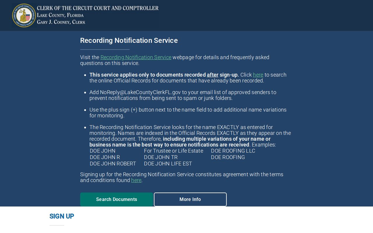
The captured form reinforces that alerts track recorded names, while GIS remains the right source for a nearby parcel set.
Protect Lake County Neighbors' Privacy
Parcel records omit many renters and household members. Utility customer files, delivery data, and motor-vehicle personal data are not open resident rolls. Florida's Address Confidentiality Program gives qualifying victims a substitute mailing address and voter suppression. Other officials, victims, and family members may receive protection under chapter 119.071. A blank or redacted field should remain unavailable, not be rebuilt from nearby sources.
Online image limits do not always seal the underlying record. Certain military discharges, death certificates, and family, juvenile, or probate court images cannot be displayed online under Florida procedures, while eligible office access may remain. Ask the custodian what can be inspected or copied. Do not infer a hidden person's identity from adjacent parcels, relatives, or past records.
Lawful use. Use neighbor records for civic curiosity, reconnection, and personal safety awareness. Never use them to watch, harass, intimidate, or harm anyone.